Archive
An update on the World Bank’s Spatial Agent
To find out, I began by watching a webinar that Mr Harshadeep recently conducted, which is as of this writing, still available online, here, after a short registration process. In the webinar, and after my subsequent investigations, I was amazed at how the Spatial Agent as an app could bring together on-demand thousands of free, public-domain spatial data and analytical services (from in-situ and earth observation sources and also live cloud computing services). It represents the data from sources such as the UN, NASA, NOAA, ESA, World Bank, many universities, and thousands of other sources, covering themes such as social (poverty, water supply), environmental (land use, biodiversity), economic (GDP, energy), and climate (snow cover, precipitation, for example).
The goal of the Spatial Agent is to offer solutions to many of the development challenges faced across the globe, which are often hampered by the poor availability of spatial data. For example, the app can be used to determine the areas in Madagascar that are susceptible to cyclones, or the areas in India that have high child malnutrition, or discovering the major exports of Vietnam, or determining how fast the population in Lagos is rising. As these examples show, the Spatial Agent’s data cross boundaries, disciplines, and cover many different scales. The Spatial Agent is the creation of Nagaraja Harshadeep, the lead environmental specialist and global lead for watersheds at the World Bank. Mr Harshadeep has decades of experience working with spatial data and the application reflects his knowledge and passion. There is much more than maps and imagery here, but rich tabular databases and other services, and the metadata for each of the data sets is quite robust.
I have been a long time fan of the spatial data from the World Bank, and use their data in several systems, including many layers available in ArcGIS Online. The major limitation with the Spatial Agent app at this point that I can see is that it is just that — an app. Therefore it only works on mobile phones and tablets. I understand in part why it is focused on these devices–these are what many people are using day to day in their work. Still, to bring the data sets into a GIS and more fully use them, I would love to see its capabilities inside of a series of user-driven interfaces that could be run in a standard web browser on a computer where I also have GIS and statistics tools available to me. But I was glad to see this note about this very thing on the project’s site: “The web version is being developed with the Bank’s Global Reach effort for launch later this year.” Since the data and documentation are so rich on this site, I look forward to finding out how we will be able to use the services in a GIS. Even without a GIS, the Spatial Agent is already very useful, because it is helping to bring data-driven decisions to daily decision making.


Two views of the hundreds of data layers and statistics available via the Spatial Agent.
For more information, including the links to access the apps, and the tutorials, see this page.
A review of the ArcGIS Pro Cookbook
GIS Professional Tripp Corbin’s book, the “ArcGIS Pro 2.x Cookbook” (2018, Packt Publishing) is new but I believe will quickly become a valued and oft-used resource. Mr Corbin’s goal in writing this extensive (694 pages) resource is to help GIS professionals “create, manage, and share geographic maps, data, and analytical models using ArcGIS Pro.” The audience for this book includes all who are learning GIS, or learning Pro, as well as those migrating from ArcMap to Pro.
Tripp’s “cookbook” theme is evident throughout the book’s format, where in each section and problem to be solved, he shows how to get ready, how to do it, how it works, and … “there’s more” (additional resources). That the book is from Packt is excellent, because Packt (www.packtpub.com) offers eBook versions of every one of its books, and also offers newsletters and tech articles. That Tripp is a full time trainer and instructor is evident–he understands the challenges in learning a rapidly-changing and complex technology inherent in GIS with just enough tips to keep the reader engaged. He also encourages the reader to think about how to apply each tool and method to his or her own work. He offers the reader the ability to download the sample data for the book, and the data bundle is also on GitHub. He also includes PDFs of all images of screen shots and diagrams.
I like Tripp’s approach because, similar to my own instruction, and central to the theme of this blog, he starts with data. He’s not hesitant to discuss the benefits but also the limitations of each data format such as shp, gdb, and CAD files. He spends quality time in the book helping the reader understand how to convert data to the format that best fits his or her needs. His sections on linking tables from outside sources to existing data, on editing (in particular, a focus on topologies to improve data accuracy and increasing editing efficiency), and on 2D and 3D analysis are very helpful. I was pleased to see much attention to what I consider to be a chief advantage of Pro–the ability to more easily share content from Pro to ArcGIS Online and hence the wider community. Another wonderful new function in ArcGIS Pro is also included in the book–writing and using Arcade scripts, applied to symbology, classification, and analysis.
As a GIS book author, I know the challenges faced in writing such a book–what should be included, and what should be left out? Tripp does a nice job here as well, including the fundamentals that most users will touch. The book’s chapters include: 1: Capabilities and terminology. 2: Creating and storing data. 3: Linking data together. 4: Editing spatial and tabular data. 5: Validating and editing data with topologies. 6: Projections and coordinate systems. 7: Converting data from one format to another. 8: Proximity analysis. 9: Spatial statistics and hot spots. 10: 3D maps and 3D analyst. 11: Arcade, labeling and symbology expressions. 12: ArcGIS Online, 13: Publishing your own content to ArcGIS Online. 14: Creating web apps using ArcGIS Online.
These chapters cover a great deal of ground. In the editing chapter, for example (Chapter 4), configuring editing options, reshaping existing, splitting, merging, aligning, creating new point line polygon features, creating new polygon feature using autocomplete, and editing attributes using attribute pane and in the table view, are all examined. The examples in the book are interesting and relevant, and not without some humor (Trippville is a community that is often studied). In my view, the book contains just the right amount of graphics. Tripp provides answers to the questions he poses, and then gives the explanation for each answer. Despite the “recipes” provided in the cookbook, not all of them require the previous recipe to be used, which is excellent for all of us in GIS who have limited time and want to select sections in a non-sequential order.
I highly recommend using this book in conjunction with Tripp’s other book on this topic, “Learning ArcGIS Pro.” The Learning book focuses on installing, assigning licenses, navigating the interface, creating and managing projecrts, creating 2D and 3D maps, authoring map layouts, importing existing projects, creating standardized workflows using tasks, and automating analysis and processes using modelbuilder and python. The Learning ArcGIS Pro book ideally should be used first, before the ArcGIS Pro 2.x Cookbook, but if you are pressed for time, these two books could be used in tandem. Keep both of them handy–they will be very useful to you.
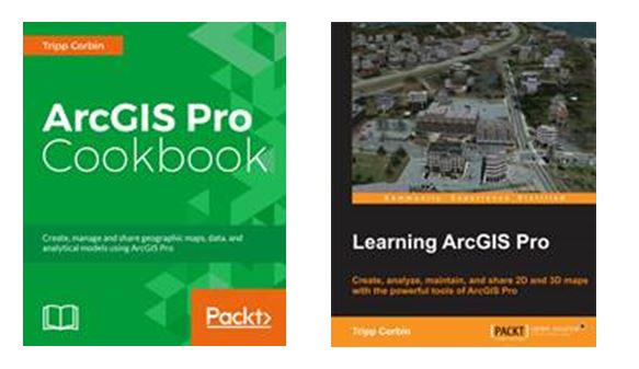
Covers of Tripp Corbin’s ArcGIS Pro books.
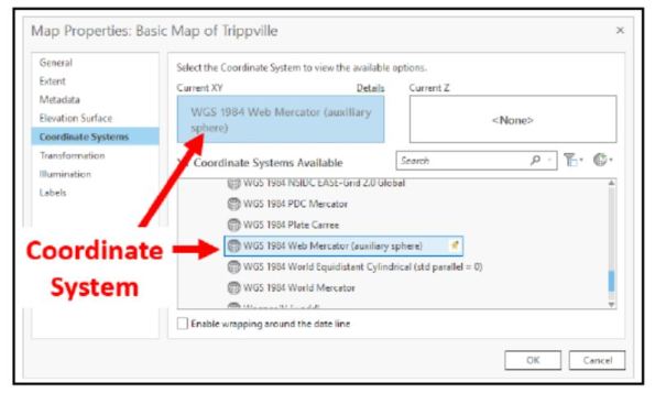
An example of the detail provided in Tripp Corbin’s ArcGIS Pro 2.x Cookbook.
Contributors
Gallery


Recent Comments