Archive
Be critical of the data even in a time of crisis
The article that recently appeared about the discrepancies in COVID-19 cases and tests fits squarely into the theme of our book and this blog. I invite you to read or skim the article, but just in case the article is no longer available by the time you read this essay, or you would just like a synopsis, it is essentially about this: Some discrepancies about the same data on the same date existed between two data sources. To the readers of this blog and to users of GIS, this is not unexpected: The geospatial data community is trained to examine multiple sources when mapping and making decisions, and collectively, the community has probably encountered this same situation on a weekly if not a daily basis.
Why did the situation in the recent article merit attention? In this case, it was about COVID-19 cases and testing, already a topic intertwined with many emotions, and for good reason. But another reason is that high ranking government officials were quoting one website, Worldometer, and other sources were quoting and using Johns Hopkins University’s site, and others. Why were there differences in the data among the sites?
I have used sites like Worldometer that contain little metadata at times for teaching purposes, but obviously with caution. Worldometer’s population “clock” or “gauge” style of presenting data on world population, for example, makes for compelling teaching, as the population ticks up by several people every second, lending a sense of urgency that can frame discussions about the need for effective planning for agriculture, transportation, water, energy, and other aspects of society. But again, I always use these sites with a wary eye.
The difficulty of discovering how the Worldometer COVID-19 data was derived is the focus of this article. The article’s “sleuthing” style, even going so far to determine the author(s) of the organization behind the data sites, makes for, in my view, interesting and important reading for students or anyone who is working in GIS or data science.
My key takeaways from this story are: (1) As we rely increasingly on real-time and near-real time data feeds, whether about health, or flood stage, or wildfire perimeters, or any other data that is used to make daily decisions, and (2) as the data is increasingly being shared and reported on almost instantly to millions of people, it is more important than ever to understand the source, scale, date, attributes, and other characteristics of the data.
Perhaps the title of this essay needs to be changed from “Be critical of the data even at a time of crisis” to “Be critical of the data especially at a time of crisis”. But I would take it a step farther: “Be critical of the data even when there is no crisis!”
–Joseph Kerski
COVID-19 and Privacy Concerns
Geospatial technology and spatial data are being used to tackle all major world issues, including the current COVID-19 situation. And because the COVID-19 situation is so tied to individuals and their movements over space and time, it is no surprise that needs for data bump into privacy issues. A recent article entitled, “As COVID-19 Accelerates, Governments Must Harness Mobile Data to Stop Spread” with a subtitle of, Despite privacy concerns, “contact tracing” using GPS data may be our best bet to contain this large and fast-growing pandemic, was recently published here, via MIT Press.
In the article, the authors, Shekhar and Shekhar, from the University of Minnesota and the Yale School of Medicine, respectively, argue that smartphone-enabled location tracing without explicit permission from the smartphone owner needs to be implemented without delay to save lives. The authors even lay out a specific plan for it to happen, and also comment that, “If smartphone trajectories of non-infected individuals need to be excluded for privacy reasons, the locations and times of potential exposure could be publicly shared without divulging patient names or sensitive medical information.”
No doubt that in the days and weeks to come, societies will have to make some difficult decisions regarding data and privacy, given the challenges before us.
–Joseph Kerski
Know Your Data! Lessons Learned from Mapping Lyme Disease
I have taught numerous workshops using Lyme Disease case counts from 1992 to 1998 by town in the state of Rhode Island. I began with an Excel spreadsheet and used Esri Maps for Office to map and publish the data to ArcGIS Online. The results are shown on this interactive map.
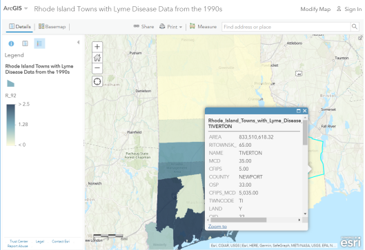
Rhode Island Lyme Disease rates from the 1990s.
As the first decade of the 2000s came to a close, my colleague and I wanted to update the data with information from 1999 to the present, and so we contacted the people at the Rhode Island Department of Health. They not only provided the updated data, for which we were grateful, but they also provided valuable information about the data. This information has wider implications for data quality in general that we frequently discuss on this Spatial Reserves blog.
The Public Health staff told us that the Lyme disease surveillance is time and resource intensive. During the 1980s and 1990s, as funding and human resource capacity allowed, the state ramped up surveillance activities including robust outreach to healthcare providers. Prioritizing Lyme surveillance allowed the state to obtain detailed clinical information for a large number of cases and classify them appropriately. The decrease observed in the 2004-2005 case counts was due to personnel changes and a shift in strategy for Lyme surveillance. Resource and priority changes reduced their active provider follow up. As a result, in the years since 2004, the state has been reporting fewer cases than in the past. They believe this decrease in cases is a result of changes to surveillance activities and not to a change in the incidence of disease in Rhode Island.
If this isn’t the perfect example of “know your data”, I don’t know what is. If one did not know the above information, an erroneous conclusion about the spatial and temporal patterns of Lyme disease would surely have occurred. This kind of information often does not make it into standard metadata forms. This therefore is also a reminder that contacting the data provider is often the most helpful way of obtaining the “inside scoop” on how the data was gathered. See my video highlighting these points. And rest assured that we made certain that this information was included in the metadata when we served this updated information.
–Joseph Kerski
Know Your Data! Example from Mapping Lyme Disease
I recently taught a workshop using Lyme Disease case counts from 1992 to 1998 by town in the state of Rhode Island. I started with an Excel spreadsheet and used Esri Maps for Office to map and publish the data to ArcGIS Online. The results are here.

Rhode Island Towns Lyme Disease Rate – 1998.
After the workshop, my colleagues and I wanted to update the data with information from 1999 to the present, and so we contacted the people at the Rhode Island Department of Health. They not only provided the data, for which we were grateful, but they also provided valuable information about the data. This information has wider implications for data quality in general that we frequently discuss on this Spatial Reserves blog.
The Public Health staff told us that the Lyme disease surveillance is time and resource intensive. During the 1980s and 1990s, as funding and human resource capacity allowed, the state ramped up surveillance activities including robust outreach to healthcare providers. Prioritizing Lyme surveillance allowed the state to obtain detailed clinical information for a large number of cases and classify them appropriately. The decrease observed in the 2004-2005 case counts was due to personnel changes and a shift in strategy for Lyme surveillance. Resource and priority changes reduced their active provider follow up. As a result, in the years since 2004, the state has been reporting fewer cases than in the past. They believe this decrease in cases is a result of changes to surveillance activities and not to a change in the incidence of disease in Rhode Island.
If this isn’t the perfect example of “know your data”, I don’t know what is. If one did not know the above information, an erroneous conclusion about the spatial and temporal patterns of Lyme disease would surely have occurred. This kind of information often does not make it into standard metadata forms. Thus, this is also a reminder that contacting the data provider is often the most helpful way of obtaining the “inside scoop” on how the data was gathered. And you can bet that we will make sure this information is included in the metadata when we serve this updated information.
Contributors
Gallery


Recent Comments