Archive
Exploring the Colorado Geospatial Portal
The Colorado Geospatial Portal (https://geodata.colorado.gov/) allows both trained GIS professionals and members of the general public to discover geospatial technology across the state. The site includes a spatial data portal, a map viewer to visualize various datasets, links to state and federal geospatial partners, and open resources such as trainings. The goal of the site is to provide a centralized location for all GIS users to find data, explore applications, or find contacts for their own purposes. As a longtime resident of Colorado, I can attest to the vibrancy of the GIS community here. This portal is indeed what many of us have been dreaming about for years; therefore I salute Jackie Phipps Montes, our state of Colorado GIO, and her team. Jackie says the following:
“The Spatial Data Portal aims to provide accessible and authoritative data to drive decision-making statewide. Previously, geospatial data could be found across 14 different locations such as the Colorado Information Marketplace (CIM) or individual agency websites. However, these methods either have limited geospatial functionality or rely on the end user to understand the agency structure across the state. The Spatial Data Portal tries to remove this barrier. We work with our agency partners to pull their data, maps, applications, and links to their geospatial resources. The result is one place to discover the numerous resources across the state.”
“These efforts aim to make geospatial more discoverable for a wide audience. We want our geospatial technologies, data, and resources to fully embrace the Digital Equity, Literacy, and Inclusion Initiative. The Governor’s Office of Information Technology will continue curating content for the Spatial Data Portal striving to provide relevant data, consistent sources, and to provide resources to make navigating and using geospatial technology and data easier in the State of Colorado.”


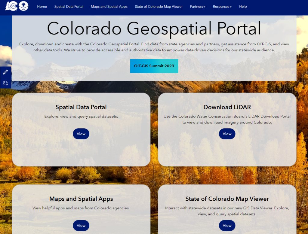
I look forward to your reactions and how you are using the portal!
—Joseph Kerski
City and County of Denver ArcGIS Online hosted feature services now available from open data catalog
The City and County of Denver have long been a leader in providing a wide variety of useful geospatial data. When I was working as a geographer at the US Census Bureau, I remember they were one of the few local governments actively maintaining their GBF/DIME file, even before TIGER existed! They continue to be innovative today, as evidenced in this recent announcement: “All publicly available GIS layers from the Denver Open Data Catalog are now accessible as Hosted Feature Services in ArcGIS Online via REST Endpoints. These layers are classified as authoritative organization data. Dynamic layers are updated nightly and all others as needed.”
Each layer is provided in multiple formats, and there are multiple ways to access and find these layers, as follows:
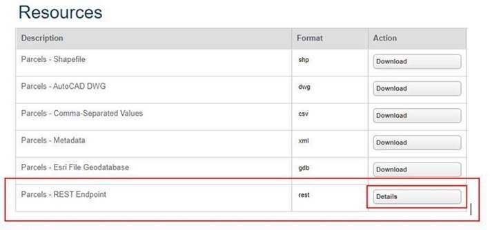
- Start with the open data catalog and choose the format you desire–shapefile, geodatabase, dwg, csv, or REST endpoint. The first formats will allow you to download the data to your device and add it to your GIS; the latter format will allow you to directly stream in the data to your GIS. This blog essay will focus on the latter.
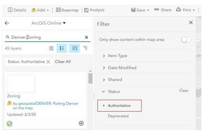
- Search for content directly in a web map inside ArcGIS Online: Search ArcGIS online for “Denver” with any word after that, making sure to filter by what is authoritative and provided by “geospatialDenver” as the owner.
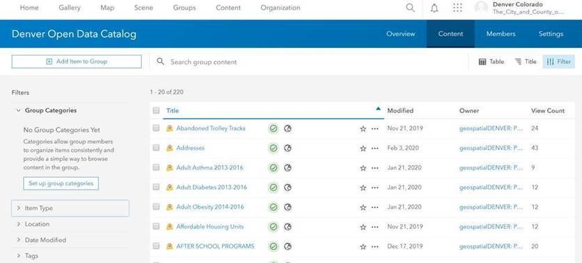
3. In ArcGIS Online, search the Open Data Catalog group for content, as shown below:

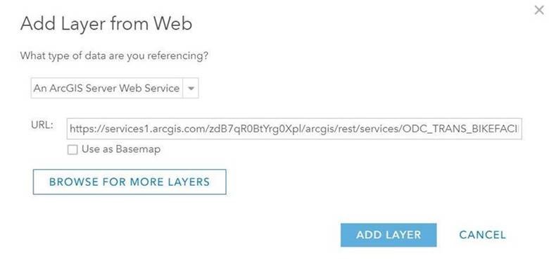
4. To your existing content in ArcGIS Online, use the Add Data tool, and use a REST Endpoint URL from the Open Data Catalog: https://www.denvergov.org/opendata
I salute the good folks at the City and County of Denver for making this happen and I encourage other local government agencies to consider doing something similar.
–Joseph Kerski
Going public with government data
Recent events in Colorado have once again highlighted just how important it is to have access to current and accurate spatial data when faced with extreme events such as wildfires.

Aftermath of High Park wildfire, Colorado, 2012
Contributors
Gallery


Recent Comments