Archive
The use of administrative data to improve state decision-making, with connections to GIS
An article on the use of administrative data to improve state decision making has, I believe, key implications for those of us involved with creating, coordinating, and using geospatial data. “As state leaders seek to harness data in innovative ways, what common themes, noteworthy successes, and notable challenges have the 50 states in the USA experienced across a broad cross section of issue areas? To address these questions, The Pew Charitable Trusts interviewed state leaders across the U.S. in 2016 and reviewed relevant laws, documents, and policies in all 50 states. This report is the culmination of that research, and the first comprehensive overview of how data is being utilized in all 50 states.”
Using data from over 350 interviews with key state officials, the report highlights ways in which some government leaders have employed sophisticated data analytics, to craft policy responses to complex problems, improve service delivery, manage resources, and examine program effectiveness. The five key actions identified that state leaders could take are: Plan ahead, including the use of data!, build the capacity of stakeholders to use data, create meaningful information from data, and sustain support for data efforts. The complete 61 page report is linked to the above summary.
The report’s thoughtful recommendations go far beyond the “hey, let’s employ data driven decisions” that we hear so much about these days. For large organizations such as state or regional government agencies to effectively use data, data literacy needs to be built in that organization, so that people can make sense of that data, and those efforts need to be supported and funded. I would even go beyond this and say that the efforts of the education outreach team on which I serve at Esri and all those involved with GIS education play a key role, because the development of geographic literacy takes time and must include all levels of education–primary, secondary, university, and lifelong learning, and include formal and informal settings.
I will also state that while geospatial data is not mentioned in the summary, and only a few times by name in the report itself, GIS is the force behind and needs to be recognized as the force behind each one of these data initiatives. Examples of the importance of GIS are all over this report, from the vehicle crash incidents map in Indiana, to natural hazards assessment in Oregon, to opioid overdoses in Massachusetts. But I would also say that it is up to us in the GIS community to make sure we draw out the importance of GIS in reports and recommendations such as this in the presentations we give, meetings we attend, and items that we author. As GIS becomes more of an enterprise solution, embedded in the day-to-day work that organizations do, I am concerned that GIS could get “buried” or taken for granted. I believe that it must be continually cited so that it is supported and funded into the future.
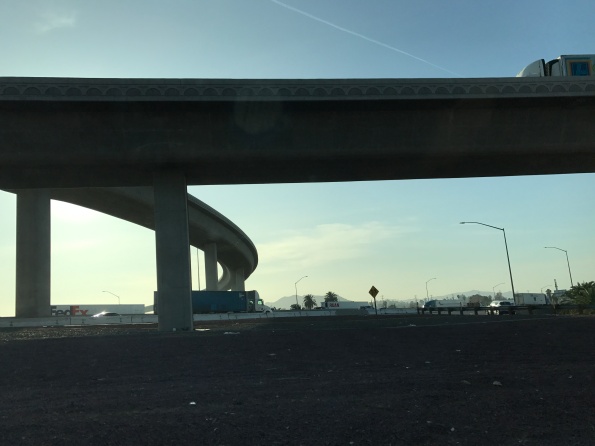
Transportation is one obvious ongoing need that large government agencies will need to address into the future with data and GIS technology, but there are many others, identified by the Pew Trust’s report that I describe here. Photograph by Joseph Kerski, sitting at a dead stop along Highway 60 in California.
Key statements about the importance of spatial data
Sometimes it is helpful to have some research results and quotes in support your data advocacy efforts at your own organization–in your promotion of “why this all matters!”. And, of course, why your efforts need to be funded and supported! Here are a few key quotes about the importance of spatial data–and what happens when the data doesn’t exist.
Kathryn Sullivan, former NASA astronaut, recently commented, The power of a map to put time and place and phenomena together, to give it to our brains through the most potent input sensor human beings have — our eyes — is a remarkable accelerator for the comprehension and engagement and use of the data that tell us what’s on Earth, where are things happening on our planet … as reported in Cheney, S. (2017). How GIS can help us understand our changing oceans. (quoted on the 2017 Esri Ocean GIS Forum on https://www.devex.com/news/how-gis-can-help-us-understand-our-changing-oceans-91366).
Another extremely useful statement is, “Advances in research on resilience and vulnerability are hampered by access to reliable data” can be found in Barrett, C. B. and D.D. Headey. 2014. Measuring resilience in a risky world: Why, where, how, and who? 2020 Conference Brief 1. May 17-19, Addis Ababa, Ethiopia. Washington, D.C: International Food Policy Research Institute.
“The lack of data is one of the biggest obstacles to progress toward development goals” was a part of the statements from the United Nations Independent Expert Advisory Group (UN). 2014. A World That Counts: Mobilising the Data Revolution for Sustainable Development. A Report to the UN Secretary General. New York, NY: United Nations, pp.28.
Perhaps the strongest argument for more and better data comes from ODI’s report The Data Revolution: Finding the Missing Millions, where the authors cite numerous cases where inadequate data leads to sub-optimal policy decisions. These cases “confirm some of the anecdotal evidence about the lack of good data in developing country ministries.” The full citation is: Stuart, E., E. Samman, W. Avis, and T. Berliner. 2015. The data revolution: finding the missing millions. ODI Research Report 03. London: Overseas Development Institute, pp. 51. (https://www.odi.org/sites/odi.org.uk/files/odi-assets/publications-opinion-files/9604.pdf).
Based on the research that Jill Clark and I have done in this area over the past decade, I would add to the ODI statement that in developed countries, some similar challenges exist. We have documented those in these blog essays for six years.
I sometimes use the statements from this National Academies of Sciences report and these written by vterrain.org. I have created videos on this topic such as here and articles such as in Directions Magazine here.
My own contribution to these quotes is, “We have made much progress, to be sure, but the world’s increasingly complex and serious issues are not going to wait around another generation for us to get our data act together.”
What are the quotes and studies you are using in your own data advocacy efforts? Please share those in the comments section.
 Photograph by Joseph Kerski.
Contributors
Gallery


Recent Comments