Archive
Explore the world with the new Landsat Explorer
The Esri Landsat Explorer app (https://livingatlas.arcgis.com/landsatexplorer) from Esri has been re-released, updated, and improved. Because this is such an amazing tool and data set, we have written about the Landsat Explorer several times in the past on the Spatial Reserves data blog, such as here, but good news! The Landsat Explorer has been recently upgraded with a new interface and with new data. With it, you can instantly analyze more than 500,000 Landsat 8 and Global Land Survey (GLS) orthorectified, cloud-minimized scenes, offering global coverage with over 500 new scenes added every day and extending back in time to the 1970s. The app is free, easy to use, and requires no download or installation required. It offers:
- Visual exploration of a dynamic global mosaic of the best available Landsat scenes.
- On-the-fly multispectral band combinations and indices for visualization and analysis.
- Interactive Find a Scene by location, sensor, time, and cloud cover.
- Visual change over time with Swipe and Animation modes.
- Spectral analysis for vegetation, water, land surface temperature, and more.
To discover more, read these short essays by my colleagues: https://www.esri.com/arcgis-blog/products/imagery/imagery/check-out-esris-new-landsat-explorer-web-app/ and https://www.esri.com/about/newsroom/announcements/esri-releases-new-landsat-satellite-data-app-to-view-and-analyze-land-changes/.
You can even toggle to the equally amazing Sentinel-2 Land Cover Explorer in this app.
I find the new version of the Landsat Explorer the best one yet. It was for years already one of my favorite apps to teach with and learn from, but now it is even easier to create a swipe showing 2 different time periods, animate the change, and render the imagery in different ways, for example, to see the Richat “eye of Mauritania” in the dynamic renderer, go here in the app:
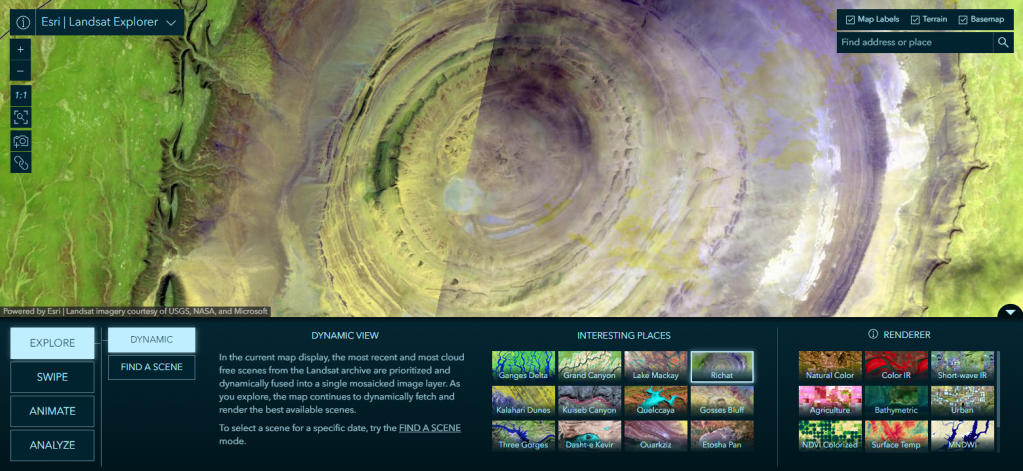
Educators can use the tool to teach about, and students and learners of all ages can use the tool to learn about: Natural hazards, volcanism, coastal process, population growth and decline, river dynamics (sedimentation, deltas, meanders, oxbow lakes), agricultural practices, transportation arteries, lake and ocean depth, de-vegetation and revegetation, and more. I have used the former iterations of this app in secondary schools, community, technical, and tribal colleges, and in universities. I also use its “interesting places” and also local places for my general public talks and keynote addresses. The app can be used in a wide variety of disciplines including physical and cultural geography, biology, natural hazards, climatology, agriculture, and even in political science (what is the land use like along borders?), archaeology, urban planning, and more.
The app’s imagery layers from Landsat can be effectively used in remote sensing and GIS courses. The same imagery layers can be brought into ArcGIS Online and ArcGIS Pro for further analysis. In addition, it is a well-designed app that can be effectively showcased when instructors ask students to create their own apps in ArcGIS (using Instant Apps, or Experience Builder), considering the tools, audience, content, and purpose of those apps.
–Joseph Kerski
Is Everyone a Geographer? Data users as data producers
I have written an essay entitled “Is Everyone a Geographer?”
https://community.esri.com/t5/education-blog/is-everyone-a-geographer/ba-p/892500
In addition, my colleague Barbaree Duke and I included this topic in our recent article, Geography in Everyday Life, in Directions Magazine, here:
I pose this question to the readers of this Spatial Reserves blog because it has direct ties to our book “The GIS Guide to Public Domain Data.” In the Public Domain Data book, we discuss the implications that crowdsourcing has had on the availability, formats, timeliness, and quality of spatial data, and the fundamental shifts it has caused in organizations and for individual GIS data users. Nowadays, everyone is a potential spatial data user, which is quite different from the world of even a few years ago. But even more of a radical shift is that nowadays, everyone is a potential data producer, as well. Whereas in the not too distant past, international and national agencies such as the USGS, UNEP, Ordnance Survey, local governments and authorities, universities, and non-government organizations were the only data producers, now, anyone with a smartphone can contribute data to the GIS cloud and share it so that others can use it. We are only just beginning to grapple with the effects this has had and will increasingly have on the world of GIS.
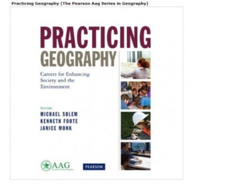
The book, pictured below, Practicing Geography, is, as the title suggests, stories about people making a positive difference in our world in their everyday jobs. These careers are interesting, diverse, and really show how geography can be applied to practical everyday decision making. I contributed a chapter with several colleagues of mine that shows how students can be engagingly taught about geography careers. The book also illustrates this notion of geography in our everyday lives, as exemplified by the career pathways described in the book.
We look forward to hearing your thoughts about this subject.
–Joseph Kerski
A list of the 100 Best GIS Blogs and Websites
A list of the 100 best GIS blogs and websites has been published, here:
https://tech.feedspot.com/gis_blogs/ [tech.feedspot.com]
As a key theme of Spatial Reserves is to be critical of any data, the title of “the top 100” should at least raise eyebrows. Whose “top”? What about others’ “top” lists? But after examining the resource, I learned about some new and useful resources, and was reminded of resources I had forgotten about. Yes, there are a few ads, but it is worth spending time with this resource and I salute its authors for doing some very good homework and research to compile it.
Or — was the list auto-generated? Again in keeping with the theme of our data blog about being critical of the data, note that GIS Lounge is listed, but GIS Lounge ceased in November 2023 (!), when it merged with Geography Realm. To find out more about Feedspot, see this page: https://feedspot.uservoice.com/knowledgebase/topics/53870-about-feedspot
Despite all of this, I was glad to see our own Spatial Reserves listed ! (#63)

We look forward to hearing what new resource you learned about in this list.
—Joseph Kerski
Contributors
Gallery


Recent Comments