Exercises and data for the book
The GIS Guide to Public Domain Data is accompanied by 10 exercises that guide you through the process of locating, downloading, processing, and analyzing some public domain spatial data. The lessons are available for use both in ArcGIS Pro or in ArcGIS Desktop (ArcMap) (if you are seeking these, skip to The ArcGIS Desktop section in this document). Which version should you use? We strongly recommend you use ArcGIS Pro for the modern GIS experience.
Summary of Lessons:
- Can be used in full, in part, or modified to suit your own needs.
- 10 lessons.
- 64 work packages. A “work package” is a set of tasks focused on solving a specific problem.
- 370 guided steps.
- 29 to 42 hours of hands-on immersion.
- Over 600 pages of content.
- 100 skills are fostered, covering GIS tools and methods, working with data, and communication.
- 40 data sources are used covering 85 different data layers.
- Themes covered: climate, business, fire, floods, hurricanes, land use, sustainability, ecotourism, invasive species, oil spills, volcanoes, earthquakes, agriculture.
- Areas covered: The Globe, and also: Orange County California, Nebraska, Colorado, Texas, Brazil, New Zealand, the Great Lakes of the USA, Canada, the Gulf of Mexico, Iceland, the Caribbean Sea, and Kenya.
- Aimed at university-level graduate and university or community college undergraduate student. Some GIS experience is very helpful, though not absolutely required. Still, my advice is not to use these lessons for students’ first exposure to GIS, but rather, in an intermediate or advanced setting.
Why use these lessons? The lessons offer 8 unique advantages:
(1) The lessons engage students by focusing on the geographic inquiry process, beginning with the problem to be solved, such as the optimal site for siting a new business in a metropolitan area, the rate and pattern of the spread of an invasive species, the ideal locations for growing tea in Kenya, assessing reservoir and dam vulnerability in the event of a hurricane, and more.
(2) While those working through the lessons build solid GIS skills (building expressions, joining data layers, intersecting, projecting, georegistering imagery), skills are not limited to “learning more GIS“. Skills in data management and communication are a prominent part of these lessons. At the end of each lesson, students are asked to communicate the results of their research in a variety of ways, including sharing to ArcGIS Online, making a short video, and creating a web mapping application such as a story map.
(3) A significant proportion of each lesson touch on accessing, formatting, projecting; i.e. developing data competencies. Helping people make wise decisions about the data, and giving them practical skills in doing so, is one of our chief goals with these lessons and the book. A balance is struck between engaging with enough data to provide a realistic scenario, but recognizing that “more is not always better.”
(4) The same lesson is available in an ArcGIS Desktop (ArcMap) format and an ArcGIS Pro format, so that those still hesitating about migrating from ArcGIS Desktop to ArcGIS Pro can use these as an example that it is not only possible, but there are many advantages to doing so.
(5) Questions posed in each lesson focus on thoughtful reflection about the data and the process, such as, “what difference would data at a different scale have on your analysis results?”, “what was the most significant thing you learned about natural hazards in this lesson?” and “if you had more time, what data set might you have also wanted to include in your analysis? Where do you think you could obtain such data?”
(6) These lessons have been tested and refined over several terms with students across many universities.
(7) An answer key is available for each lesson. But in keeping with the reflective nature of these lessons, often there is no “single correct answer.”
(8) A lesson on building an ecotourism map in New Zealand allows students to use their gained skills in an independent project where they decide what themes to choose, what data to use, how to process it, and what problems to solve.
How to access the lessons: ArcGIS Pro versions. The original exercises were updated to ArcGIS Pro during 2020. The ideal way to work through the lessons is in a Learn Path which bundle the readings of the book’s chapters, selected blog essays, and the hands-on activities.. The Learn Path is split into 3 parts, as follows:
Solving Problems with GIS and public domain geospatial data 1 of 3: Learn how to find, evaluate, and analyze data to solve location-based problems through this set of 10 chapters and short essay readings, and 10 hands-on lessons: https://learn.arcgis.com/en/paths/the-gis-guide-to-public-domain-data-learn-path/
Solving Problems with GIS and public domain geospatial data 2 of 3: https://learn.arcgis.com/en/paths/the-gis-guide-to-public-domain-data-learn-path-2/
Solving Problems with GIS and public domain geospatial data 3 of 3: https://learn.arcgis.com/en/paths/the-gis-guide-to-public-domain-data-learn-path-3/
The Learn Paths allow for content to be worked through in sequence, as shown below:

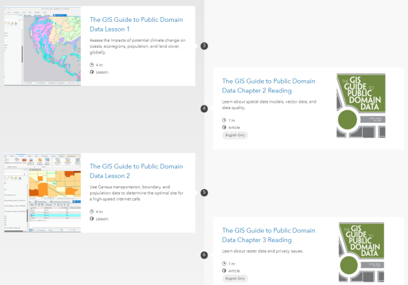
 Sample Learn Path for the public domain data activities.
You can also access the lessons by accessing this gallery in ArcGIS Online, shown below. If you would like to modify the lessons for your own use, feel free! This is why the lessons have been provided in a zipped bundle as PDF files here and as MS Word DOCX files here. This video provides an overview.
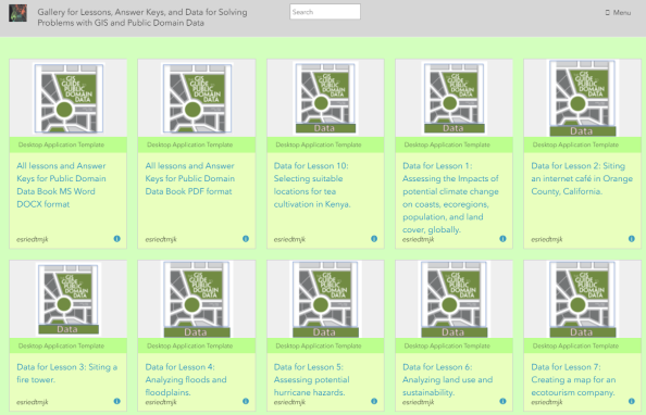
Appearance of content items in the public domain data activities and reading gallery. The gallery includes lessons, data, readings, and the answer keys.
While the intent is for learners to actually download or stream the data from the original sources as an important part of the learning experience, the data for each lesson in zip file format are also included, in this ArcGIS Online gallery. The reason the data is provided is because we recognize that sometimes, bandwidth is limited and/or the data portals are slow, change, or are temporarily offline.
ArcGIS Desktop (ArcMap). The exercises were originally created in 2012 for use in ArcGIS Desktop (ArcMap), and updated periodically throughout the ensuing 7 years. These exercises can still be downloaded (no sign in required) from Google Drive or from ArcGIS Online (procedures via this video). For an overview of the exercises and the physical location of each (Kenya, Brazil, and elsewhere), see this story map. For more information, see this video.
Leave a comment
Contributors
Gallery


Hokum!
Locations of the CORRECT copies of exercises that are available for free are not clearly communicated and so far the only CORRECT set is available on a site that charges $8.99.
https://www.scribd.com/user/139574644/jillaclark
One pays for the book and has to then fumble through various copies of the exercises to find correct copies and then PAY MORE!
My students are frustrated, I am playing catchup to support them and I do not have confidence in the above claims at this point. Bring back the old ESRI Virtual Campus and sack the (still in beta) E-Learning site foisted on colleges with two weeks notice last August.
What is happening at ESRI?
Reg Parks
Instructor / Program Coordinator
Santa Rosa Junior College
Department of Engineering and Applied Technology
Civil Engineering, Surveying and Geospatial Technology (CESGT) Program
Exercises are available, and free, on Google Drive https://spatialreserves.wordpress.com/exercises-and-data-for-the-gis-guide-to-public-domain-data/.
Important and exciting update! The ArcGIS Pro versions of these 10 exercises will be posted soon to this site!
Looking forward to the updated exercises for ArcGIS Pro!
Thanks Reginald! I am just working on the answer keys now!
Where will you be posting those? I am using the ArcMap versions and had to update some of the data links (and change them) due to the demise of GIS Data Depot and a change in the National Map. I have updated Exercise 3 (the Loess Hills assignment) and am going to update Exercise 8 (unless you have an updated version!). Thanks so much – these exercises are fantastic.
Thank you Feride! The ArcGIS Pro versions of each of these exercises will be posted here on Spatial Reserves soon, along with the data sets and the answer keys. And, as you pointed out, some of the data sources have changed, so those will be updated as well. –Joseph Kerski
The 10 new exercises for ArcGIS Pro are done! Let us know how you like them!