Landsat 8 Data Now Available on Amazon AWS
Last month Amazon announced the release of Landsat 8 data on its AWS S3 platform. The data are freely available in GeoTiff format and are not subject to any restrictions on use. The imagery is updated on a 16 day cycle and is available on AWS within hours of reception by USGS.
All of the scenes from 2015 are available, along with a selection of scenes from 2013 and 2014. For those interested in downloading the data (no Amazon account required), each scene’s directory includes the following:
- a .TIF GeoTIFF for each of the scene’s up to 12 bands
- .TIF.ovr overview file for each .TIF
- a _MTL.txt metadata file
- a small rgb preview jpeg, 3 percent of the original size
- a larger rgb preview jpeg, 15 percent of the original size
- an index.html file including the RGB preview and links to the GeoTIFFs and metadata files
As a partner in the initiative to provide easier access to the imagery, Esri has created a set of Landsat Web Services that are available through ArcGIS Online. The services provide dynamic access to the entire collection of Landsat 8 data on AWS. The web services show one Landsat 8 service that has a subset of the Landsat 8 imagery. If you are interested in downloading more, see the “downloading” link here.
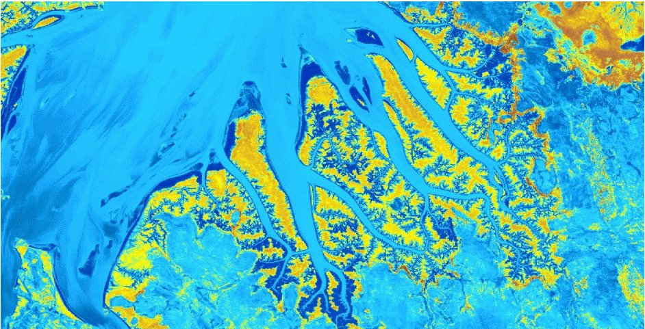
Cambridge Gulf in Australia
Leave a comment
Gallery


Landsat 8 data from 2013 and beyond is also freely available at LandViewer for viewing and analysis. It is capable of viewing both various RGB combinations and various derived products from source data – multispectral indices (as products of a higher level of processing).