Pokémon GO, GIS, and Safety
Pokémon GO has become very popular, with tens of millions of users in its first month alone, connecting users in the real world with a virtual world, using their own smartphones. Behind the scenes Pokémon GO is powered by location based services, GIS, and GPS. Pokémon GO is built on Niantic’s Real World Gaming Platform for augmented reality, allowing users to find and catch more than a hundred species of Pokémon as they explore their surroundings. Players are represented on an augmented reality map of the real world. A user’s smartphone vibrates when it is near a Pokémon. When users encounter a Pokémon, they take aim on their smartphone’s touchscreen and throw a Poké Ball to catch it. Finding Pokémon has become much easier with the release of Pokevision, a Pokemon tracker and locator. It uses the Niantic API to grab the location of all Pokemon near you (or your selected location) and displays them on the map in real-time.
This is intriguing to me as a GIS professional for several reasons. First, Pokevision uses map tiles and geocoding services from Esri. It is already the most popular app that uses Esri technology, which makes sense because it is aimed at the general public rather than GIS professionals. Second, the game encourages users to explore the cities and towns where they live to capture. As an outdoor education advocate, I am glad that people are using this game as an excuse to get outside and become active. PokéStops are located at places that I am always encouraging people to visit, such as public art installations, trails, and historical markers and monuments. But I do want people to be safe and be aware of their surroundings whether they are using this game, any other game, their phone, or a GPS. Third, as we discuss frequently in this blog, Pokémon GO is helping people think about the privacy and safety implications of location based services, including games. For example, Chi Smith created a crowdsourcing story map for users to share safety tips. As we discuss in this blog and in our book, location based services are powerful, engaging, and useful, and need to be used with care.
But like all of these technologies and the social forces surrounding them, on 1 August 2016 it was announced that the Pokemon GO developer shut down sites like Pokevision. Keep checking this blog for updates.
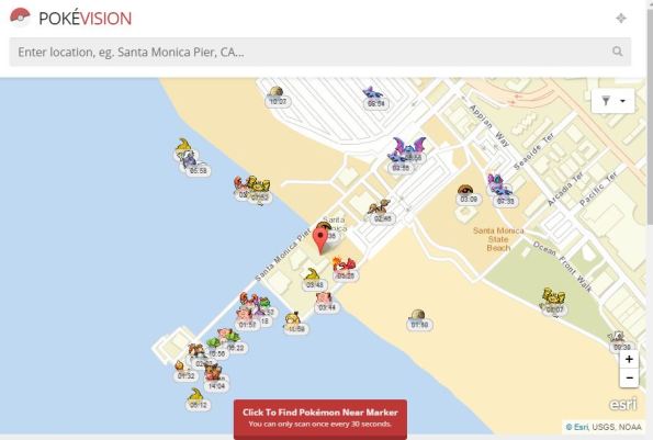
POKÉVISION view of the Santa Monica Pier in California.
Leave a comment
Contributors
Gallery


Seem to have taken PokeVisionGo down
Pokevision
@PokeVisionGo
Sorry guys – we took the Teespring down because while we do want Pokevision to be up, we can’t guarantee it & don’t want to give false hope.
More on the social and legal saga of Pokémon Go
http://blog.zolnai.ca/2016/08/massive-online-activity-all-is-not-as.html
My take on the Pokemon Go saga
http://blog.zolnai.ca/2016/08/massive-online-activity-all-is-not-as.html
Thanks Andrew! It is good to hear from you. I appreciate this!
–Joseph K
And a broader view on the whole shebang
http://blog.zolnai.ca/2016/08/a-question-of-business-models-in-webmap.html